India's Multilayered Action Against China's Medog Mega-Dam Construction
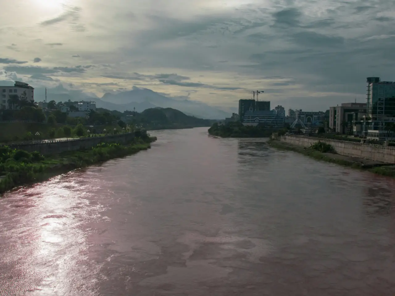
The Medog cascade, a massive hydropower project on the Yarlung Tsangpo (known as the Brahmaputra River once it enters India), is located within the Great Bend, 30 km upstream of Gelling in Arunachal Pradesh. This project, valued at 1 trillion yuan (167.8 billion US dollars) by Beijing's National Development and Reform Commission, has significant strategic, ecological, and federal impacts on India.
Strategic Impact
The dam's location near Arunachal Pradesh, an Indian state claimed by China, adds to the geopolitical tensions in the region. China's strategy to assert sovereignty over Tibetan resources and control upstream water flows is viewed as a water security threat by India [3][1]. Tibetan exiles and Indian activists see it as a "water war" strategy that potentially jeopardizes India's downstream water supplies and regional security.
Ecological Impact
Although the Medog cascade is a run-of-the-river hydropower project, its vast scale (60,000 MW capacity) and location in a fragile seismic zone raise serious ecological concerns. It threatens biodiversity hotspots, endemic species, and fragile riverine ecosystems in the eastern Himalayas. Risks include dam-induced seismic activity, erosion, landslides, floods, and the exacerbation of glacial melt dangers, such as Glacier Lake Outburst Floods (GLOFs). Local indigenous groups in Arunachal Pradesh and Assam also warn of displacement, deforestation, and loss of ancestral lands and cultural heritage [2][1].
Federal (Bilateral) Impact
India is concerned about the lack of transparency and absence of a formal water-sharing or data-sharing treaty with China regarding the Brahmaputra River. Despite India's requests for hydrological data and environmental impact assessments, China has proceeded with the project asserting full sovereignty. India is monitoring the situation closely but has issued no official protest, reflecting cautious diplomatic engagement. The project complicates India’s federal and regional water management, especially for downstream states like Arunachal Pradesh and Assam which depend on Brahmaputra flows for agriculture, livelihoods, and flood control [5][1].
Other Considerations
- Sediment entrapment by the dam threatens the stability of Majuli-island, the world's largest river island, and the agronomy of the Bengal delta.
- China is not a party to the 1997 UN Watercourses Convention.
- Anti-dam movements in Upper Siang and Dibang reflect the ongoing debate between rights and risks.
A proposed Brahmaputra River Commission under BIMSTEC (Bay of Bengal Initiative for Multi-Sectoral Technical and Economic Cooperation) aims to institute joint hydrology stations, transparent release schedules, and dispute-resolution panels. Additionally, a Brahmaputra Knowledge Corridor is proposed to provide evidence briefs for the Ministry of External Affairs and the National Security Council Secretariat.
In contrast, the Grand Ethiopian Renaissance Dam (GERD) has a negotiated fill-curve under African Union facilitation, demonstrating the potential for cooperative water management in transboundary rivers. The revenue-sharing formula of Itaipu Dam on the Paraná compensates Paraguay, showcasing benefit-sharing as a means to mitigate asymmetry.
The current flood-forecast lead time on Siang, a major tributary of the Brahmaputra, is ≤ 8 hours, insufficient for large-scale evacuation. Data opacity prevents real-time flood forecasting beyond eight hours in the Siang reach. These challenges underscore the need for improved data sharing and collaboration between India and China to ensure effective flood management and mitigation.
In conclusion, the Medog megadam intensifies Sino-Indian strategic rivalry, poses ecological risks to the sensitive Eastern Himalayas, and challenges India’s ability to manage vital transboundary water resources due to limited transparency and cooperation from China.
- The strategic location of the Medog dam, in close proximity to Arunachal Pradesh, a disputed Indian state, fuels regional geopolitical tensions.
- The vast scale of the Medog cascade, with a capacity of 60,000 MW, raises ecological concerns, threatening biodiversity hotspots and fragile riverine ecosystems in the eastern Himalayas.
- The ecological impact of the Medog dam includes potential risks such as dam-induced seismic activity, erosion, landslides, floods, and the exacerbation of glacial melt dangers.
- Local indigenous groups in Arunachal Pradesh and Assam warn of displacement, deforestation, and loss of ancestral lands and cultural heritage due to the Medog dam.
- The lack of transparency and absence of a formal water-sharing or data-sharing treaty between India and China regarding the Brahmaputra River complicates India’s federal and regional water management.
- China's strategy to assert sovereignty over Tibetan resources and control upstream water flows is viewed as a water security threat by India.
- Improved data sharing and collaboration between India and China is necessary to ensure effective flood management and mitigation, as the current flood-forecast lead time on Siang, a major tributary of the Brahmaputra, is insufficient for large-scale evacuation.
- A proposed Brahmaputra River Commission under BIMSTEC aims to institute joint hydrology stations, transparent release schedules, and dispute-resolution panels.
- The revenue-sharing formula of Itaipu Dam on the Paraná demonstrates the potential for benefit-sharing as a means to mitigate asymmetry in transboundary water management.
- The Grand Ethiopian Renaissance Dam has a negotiated fill-curve under African Union facilitation, showcasing the potential for cooperative water management in transboundary rivers.


